
Co-Written by Peter Wang and Dominic Marziali
Staff Writers
Photos by Helena Fu
Staff Photographer
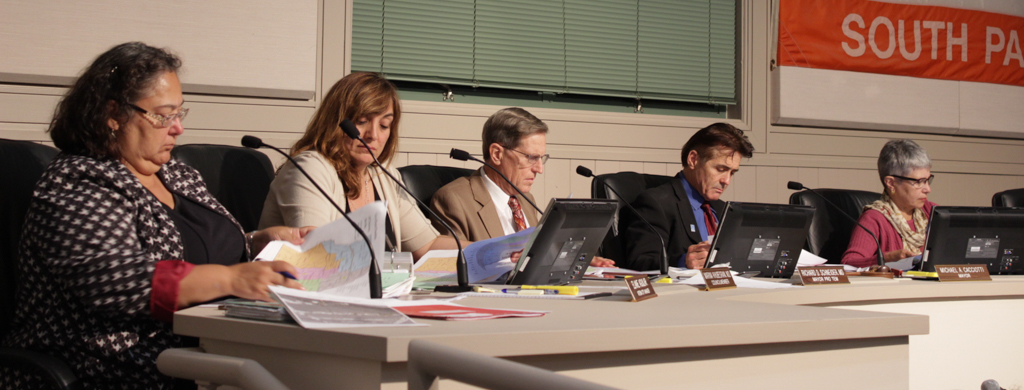
The South Pasadena City Council held its penultimate meeting regarding the transition to a district-based election system on Wednesday, September 20th. The council discussed feedback from the September 16th community workshop regarding the four proposed maps, and made live edits to the popular ‘Green Map.’ The ‘Green Map’ and its modified version were chosen as the final maps, nullifying the ‘Tan’, ‘Blue’, and ‘Purple’ maps. The council will adopt one of the two chosen maps at the next meeting.
South Pasadena must undergo the transition process under threat of a lawsuit if they were to not comply. In response to an allegation of voting rights violations by Malibu attorney Kevin Shenkman, the city chose to adopt district-based elections rather than pay hefty legal fines. Four election district maps— each compliant with demographic requirements under the California and Federal Voting Rights Acts— were proposed earlier, each with a different focus in dividing the city.
Throughout the meeting, the council suggested possible edits to the Green and Blue maps in order to meet community requests. The ‘Green Map’ was modified to keep the Central South neighborhood, the “figurative and literal core of the city”, intact. The “south of Huntington” area was also kept intact, whereas it was previously split. Instead of running north and south as in the original map, districts Four and Five now meet at Monterey Road, and are relegated to the east side of the city.
The modified ‘Green Map’ has a narrower city-wide span than the original due to the compacting of districts Four and Five, potentially resulting in less diversity of responsibilities taken by their respective councilmembers. The original map aimed to counteract possible divisions caused by districting, as each councilmember would represent a diverse range of topics that spanned from north to south.
Demographics in the modified map are also less uniform than the original, with approximately 2-3% more deviation in overall population. Countering this drawback, the city explained that a few percentage points of deviation implicated practically nothing mathematically due to outdated census data. Thus, a 26% Latino population is no different than a 28% Latino population when accounting for the margin of error, which is around 5% for the 2010 census.
The ‘Blue Map’ was also modified to keep the city’s core, or “library district”, intact. Due to similarity with the purple map, it was subsequently scrapped from consideration.
As the maps were being modified, each district had to be adjusted to meet population size requirements.
“It’s a lot like squeezing a balloon,” Chief City Clerk Anthony Mejia said of the process. “If you move one part you’ll have to move the other.”
The city council expressed great support for the amended version of the Green Map, as it met the residents’ requests and also encouraged cohesion within the city. Integrity of neighborhoods, especially Central South and Huntington, were cited by Mayor Cacciotti and Councilmember Mahmud as other strong suits of the map.
Councilmember Joe explored the possibility of reaffirming the city’s stance on city-wide cohesion and cooperation through the voting district adoption resolution. Although such language would not be legally binding, it could provide guidance to future city councilmembers. Councilmember Khubesrian made an argument for intersecting district lines, as the cooperation of two or more councilmembers can result in more comprehensive representation and greater cohesion.
“Lines on a map do not define a sense of community,” Councilmember Khubesrian said.
The council will vote to adopt the district-based election system in their upcoming October 4th meeting.